Pantiacolla
(400m)
This station is located in the lowland Amazon rainforest at 400 m elevation. Here daytime temperatures are generally above 30 ºC with high humidity -- nighttime temperatures are slightly cooler. In the late dry season, cold fronts from the south, also known as "friajes" occassionally move through the area, bringing a day or so of heavy downpours followed by several days of cooler temperatures such as those found above 1200 m in the Andes.
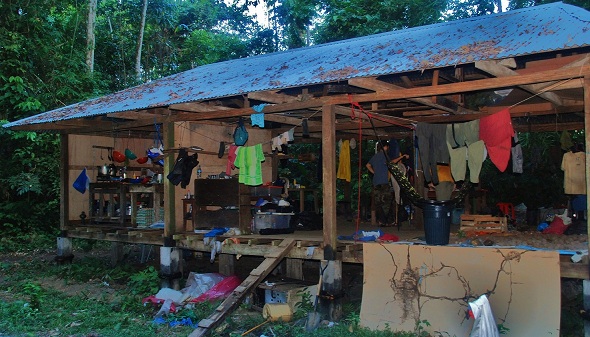
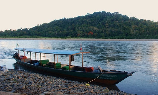
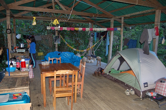
Pantiacolla is reached by traveling from Cuzco down the Manu road to one of the towns of Atalaya, Shintuya, or Itahuania and then hiring boat transport to the station. Researchers live in tents surrounding a covered central platform that sits near the Alto Madre de Dios River. We use the trail system provided by Pantiacolla Lodge, which includes over 600 hectares of mature growth lowland forest across floodplain and terra firme habitats, Guadua bamboo patches, successional Tessaria and Cercropia habitats moving away from river edges, and some areas on outlying Andean ridges up to 1000 m elevation.
The closest access to phone or internet communication is in the Amazon colonial town of Itahuania 15-20 minutes downriver, or in case of emergency there is radio contact available through Pantiacolla Lodge. Living conditions are rustic at this site. The lodge provides water for cooking, but all dish washing, laundry and bathing take place in the river, and a simple latrine has been set up to accommodate our research group. The kitchen and dining area are found on the central platform, which is also used for equipment storage and hanging clothing. We provide all food for stations and a propane tank and stove for cooking. A soccer field is located nearby, with an old cabin that is devoted to measurement of avian metabolic rates. Generator power is available at night for recharging electronic equipment and running metabolic equipment.
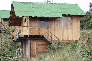
Researchers in San Pedro stay on a covered platform provided by the Cock-of-the-Rock Lodge, which is owned by Selva Sur. This station is located at 1400 m elevation in lower montane forest, or the lowest extent of cloud forest along the eastern Andean slope in what is known as the Kcosñipata valley. Daytime temperatures are generally as high as 25 ºC, and nighttime temperatures typically drop to 15 ºC during the field season.
San Pedro is located directly on the Manu road (or the Cuzco-Pilcopata highway) about 6-8 hours from Cuzco and can be reached by car or public bus. We have established a trail system that covers a range of elevations between 1200 - 2100 m. Within this range one can find montane forest, river edge forest, as well as Guadua and Chusquea bamboo habitats. Landslides are extensive here, and many areas are now recovering from a series of landslides that occurred in the late wet season of March 2010.
The station in San Pedro has basic facilities for showers and hand-wash laundry and dishes (cold water only). Bathrooms with sinks and toilets are also provided by the lodge. Our kitchen and dining area and equipment storage are located on the covered platform, which is also large enough to accommodate tents for researchers. When our generator is running, electronics can be recharged, and wireless internet is typically available in the small house next to the bathroom and laundry. This is also where avian metabolic measurements are performed. The nearest towns are Patria and Pilcopata, located about an hour and a half down the road by vehicle. These small towns have public markets for fruits and vegetables, several restaurants, and internet and payphone access. There are several other lodges operating out of the "town" of San Pedro. Señor Domitrio maintains a soccer field at his house for weekly pick-up games.
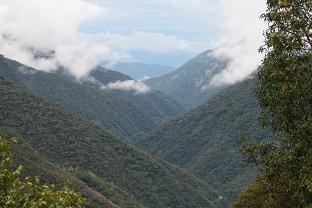
This is our highest elevation station along the gradient, located at the Centro de Investigación Wayqecha, managed by the Asociación para la Conservación de la Cuenca Amazonica (ACCA). The station is found at 2900 m elevation, which is the upper extent of cloud forest along the gradient, squeezed by the anthropogenic treeline (set by cattle grazing and fire disturbance from high-elevation communities). Daytime temperatures can be quite warm, between 20-25 ºC, and nighttime temperatures can drop to 0 ºC or just below.
Wayqecha is located directly on the Manu road, about 4-5 hours from Cuzco, and can be reached by car or public bus. We use the trail system that is maintained by ACCA, which range from 2300 - 3000 m elevation. This station includes mature humid upper montane forest as well as recovering scrub habitat, and different forest types in various successional stages with intermediate vegetation structure. Landslides are common at these elevations, and various successional areas can be observed across the landscape, including Chusquea bamboo and Alnus stands.
The station in Wayqecha has a comedor with tables for work and temporary equipment storage. There is a covered platform where researchers stay in tents. The platform sits next to a single bathroom with a sink, toilet and gas-powered hot shower. Hand-wash laundry facilities are also available. Researchers staying on the platform are served three meals a day in the comedor and have access to electricity and wireless internet via generator power between 6-9 pm. The nearest town, Paucartambo, is at higher elevation on the Cuzco-Pilcopata highway, about one to two hours traveling by car from Wayqecha. Paucartambo has markets for fruit, vegetables, several restaurants, payphones and internet access. More information on the Wayqecha station and ACCA can be found at their website. NOTE: The location for our station within Wayqecha will be relocated to a small cabin 2 km up the road from the principal station. Most living conditions will remain the same, though we will supply our own kitchen and food and will no longer have nightly access to wireless internet.